Mining Drone Technology: Surveying, Mapping & Pit Monitoring
Mining Drone Technology: The Future of Surveying and Monitoring
The mining industry is undergoing a technological revolution, and drone technology stands at the forefront of this transformation. From small artisanal operations to large-scale commercial mines, aerial drones have become essential tools for surveying, mapping, and continuous pit monitoring. For mining companies sourcing critical materials like nickel ore, silica sand, and other minerals, understanding drone capabilities can significantly improve operational efficiency and reduce costs.
Mining drones offer unprecedented access to difficult terrain, real-time data collection, and precise volumetric measurements that traditional surveying methods cannot match. Whether you're operating in the remote regions of Sulawesi, Kalimantan, or Maluku, or managing mineral extraction operations across Indonesia, modern drone technology provides the insights needed to optimize extraction, improve safety, and maintain regulatory compliance.
What Is a Mining Drone and How Does It Work?
Understanding Drone Surveying in Mining Operations
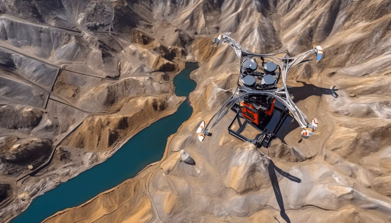
A mining drone is a sophisticated unmanned aerial vehicle (UAV) equipped with advanced sensors, cameras, and sometimes LiDAR technology. These devices are specifically designed to operate in challenging mining environments where human access is dangerous, difficult, or time-consuming.
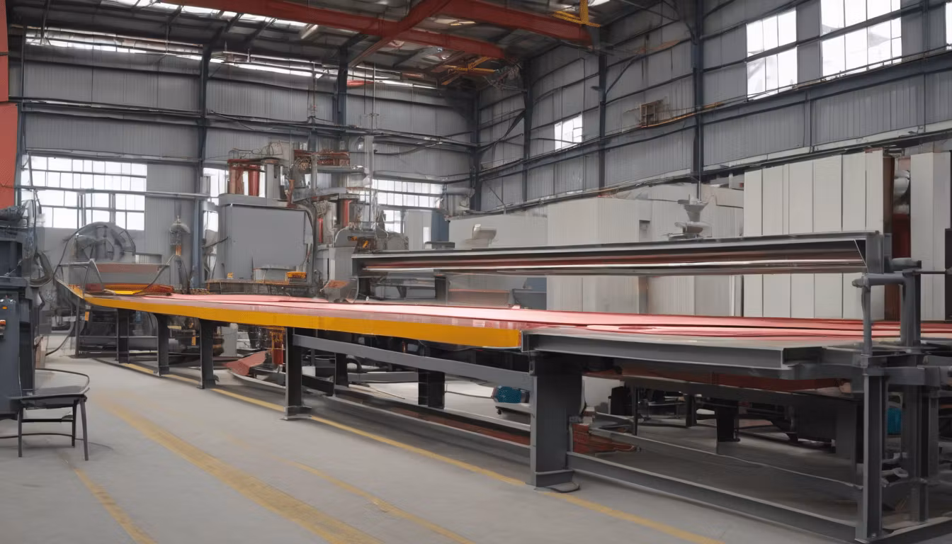
Drone surveying mines involves several key processes. The drone captures high-resolution images and sensor data from predetermined flight paths, which are then processed using specialized software to create detailed maps, 3D models, and volumetric calculations. This automation eliminates the need for manual ground surveys, which are not only labor-intensive but also expose workers to safety risks.
Modern mining drones can operate at various altitudes and speeds, adapting to different pit sizes and geological conditions. Whether surveying exposed pit walls, measuring stockpiles, or monitoring extraction progress, these aerial systems provide consistent, repeatable data that becomes invaluable for production planning and resource management.
Key Components of Mining Drone Systems
Effective drone surveying requires more than just the aircraft itself. A complete mining drone system includes:
- High-Resolution Cameras: RGB and multispectral sensors capturing detailed imagery for precise mapping
- LiDAR or Photogrammetry: Technologies that create accurate 3D point clouds and elevation models
- GPS/GNSS Systems: Ensuring precise geospatial positioning accurate to centimeter-level
- Flight Planning Software: Automated systems for designing efficient survey patterns
- Data Processing Platforms: Software that converts raw imagery into actionable mining intelligence
- Battery Systems: Extended flight time capabilities suited for large pit monitoring
Aerial Mapping Mining: Applications and Benefits
Real-Time Pit Monitoring
Drone monitoring pit operations has revolutionized how mining companies track daily progress. Instead of weekly or monthly surveys, operators can now conduct daily aerial inspections, capturing changes in pit geometry, material movement, and equipment positioning. This continuous monitoring enables:
- Immediate identification of geological anomalies or unstable slope conditions
- Precise tracking of equipment location and operational efficiency
- Rapid assessment of environmental conditions and water accumulation
- Documentation of compliance with mining permits and operational boundaries
For companies managing diverse mineral operations—whether extracting zircon sand or other mineral resources—daily drone monitoring provides the granular data needed to optimize extraction sequences and maintain safety standards.
Volumetric Measurements and Stockpile Calculations
One of the most valuable applications of mining drone technology is accurate volumetric analysis. Traditional methods requiring manual measurements and estimates are being replaced by drone-based calculations that provide accuracy within 2-3% of actual volumes. This precision is critical for:
- Inventory management and production forecasting
- Sales and contract fulfillment verification
- Operational cost allocation and margin analysis
- Resource reserve estimation
When dealing with high-value minerals or materials like aluminium ingot stockpiles, accurate volume measurements directly impact profitability and customer relations.
Geological and Topographic Mapping
Aerial mapping mining operations creates detailed topographic surveys and geological maps that inform extraction planning. Advanced drones equipped with multispectral cameras can identify different ore types and geological features based on surface characteristics. This capability enables:
- Better understanding of ore body geometry and distribution
- Identification of geological hazards before they impact operations
- Planning of optimal extraction sequences to maximize recovery
- Enhanced environmental baseline documentation
Drone Monitoring Pit: Safety and Environmental Advantages
Reducing Human Risk in Hazardous Environments
Mining is inherently dangerous. Pit walls can be unstable, equipment operates in tight spaces, and environmental hazards are omnipresent. By using drones for monitoring pit conditions, mining operators significantly reduce worker exposure to risk. Instead of sending personnel to challenging locations for surveys, drone technology allows operators to:
- Inspect pit walls and slopes from safe distances
- Monitor water levels and drainage systems without pit entry
- Document hazardous conditions for remediation planning
- Conduct safety audits without disrupting active operations
This safety advantage directly improves worker welfare and reduces insurance costs and regulatory liabilities.
Environmental Monitoring and Compliance
Mining companies operate under strict environmental regulations. Drones provide an objective, documented method for environmental monitoring that satisfies regulatory requirements. Regular aerial surveys create visual records of:
- Site rehabilitation progress and vegetation recovery
- Water management and containment effectiveness
- Dust suppression system operation
- Boundary compliance and neighboring land impact assessment
Mining Drone Technology: Cost Analysis and ROI
Operational Cost Reductions
While drone systems require initial capital investment, the operational cost savings justify the expense within 1-2 years for most mining operations:
- Labor Reduction: Eliminating manual survey crews saves 30-40% of surveying costs
- Time Efficiency: Surveys that took days now take hours, accelerating decision-making
- Equipment Wear: Reduced vehicle movement on pit floors extends equipment life
- Production Optimization: Better data enables 5-15% improvements in extraction efficiency
Measuring Return on Investment
ROI from mining drone implementation includes both direct and indirect benefits. Direct savings come from reduced surveying costs, while indirect benefits include improved production planning, reduced accidents, and better regulatory compliance. Most mining operations see:
- 25-35% reduction in surveying and monitoring costs
- 10-20% improvement in equipment utilization
- 30-50% faster response to operational issues
- Significant reduction in non-compliance incidents
Selecting and Implementing Mining Drone Solutions
Choosing the Right Drone Platform
Different mining operations have different requirements. Factors to consider when selecting a mining drone include:
- Pit Size and Geometry: Larger pits require extended flight range and battery capacity
- Environmental Conditions: Wind, humidity, and temperature affect drone performance
- Sensor Requirements: RGB cameras, multispectral, or LiDAR depending on application
- Integration Capability: Compatibility with existing mining software and workflows
- Maintenance Support: Access to local service and repair capabilities
Training and Operational Protocols
Successful drone implementation requires proper training and standardized protocols. Mining companies should establish:
- Certified drone pilot programs with regular recertification
- Safety procedures for drone operations in active mining areas
- Data quality standards and quality assurance processes
- Integration protocols with existing surveying and production systems
- Regulatory compliance documentation and audit trails
Advanced Mining Drone Applications and Future Trends
AI and Machine Learning Integration
The next generation of mining drones incorporates artificial intelligence and machine learning algorithms that automatically analyze imagery to identify geological features, equipment status, and operational anomalies. These systems can:
- Detect slope instability before failures occur
- Automatically calculate stockpile volumes without manual intervention
- Identify equipment maintenance needs through visual analysis
- Flag environmental concerns requiring attention
Autonomous Operations and Swarm Technology
Future mining operations may employ multiple drones working in coordinated patterns (drone swarms) to simultaneously map large areas and provide redundancy. Autonomous flight systems can execute complex survey patterns without real-time pilot intervention, enabling:
- 24/7 monitoring operations without continuous human presence
- Rapid response to equipment or safety issues
- Comprehensive site coverage in minimal time
- Consistent data collection following identical flight patterns
Integration with Mining Software Ecosystems
Advanced mining operations are integrating drone data directly with mine planning software, production management systems, and equipment fleet monitoring platforms. This integration creates a holistic operational intelligence system where drone data automatically informs production decisions and resource allocation.
Regulatory and Safety Considerations for Mining Drones
Airspace Regulations and Permits
Mining companies operating drones must comply with civil aviation regulations. In Indonesia, operators require specific permits from relevant authorities for operating in mining areas. Compliance includes:
- Aircraft registration and airworthiness certification
- Pilot licensing and competency standards
- Operational permits for specific mining locations
- Insurance coverage for drone operations
- Coordination with local aviation authorities
Data Security and Intellectual Property
Drone-generated data regarding pit geometry, ore quality, and extraction progress is confidential business information. Mining companies should implement:
- Secure data storage and encryption protocols
- Access controls limiting data viewing to authorized personnel
- Data retention policies complying with regulatory requirements
- Contracts with drone operators ensuring data confidentiality
Case Applications Across Different Mineral Types
Mining drone technology is applicable across diverse mineral extraction operations. Whether surveying nickel ore deposits in Morowali, monitoring silica sand pits in Kalimantan, or tracking zircon sand operations in Halmahera, drones provide consistent operational advantages. Mining companies sourcing diverse materials benefit from standardized drone protocols that apply across all commodity types and operational sites.
For companies like CV Indoalam Mineral Persada, which sources minerals from multiple regions and manages complex supply chains, drone monitoring provides visibility across all sourcing operations, ensuring quality consistency and regulatory compliance.
Partnering With Experienced Mining Suppliers
While drone technology has transformed surveying and monitoring capabilities, sourcing quality minerals requires more than technology—it requires trusted partnerships with established suppliers. As you evaluate your operations and consider implementing drone technology, ensure your mineral suppliers maintain the same commitment to precision, quality, and operational excellence.
CV Indoalam Mineral Persada operates with SUCOFINDO-tested quality standards and full IUP OPK licensing across multiple mineral types. Our experience managing complex sourcing operations from Sulawesi, Kalimantan, and Maluku demonstrates the operational excellence that modern mining demands. Whether you need nickel ore, high-grade silica sand, or specialty minerals, working with suppliers who understand both traditional mining excellence and modern technology optimization ensures your supply chain reliability.
Conclusion: The Future of Mining Operations
Mining drone technology represents a fundamental shift in how companies survey, map, and monitor operations. The precision, safety benefits, cost reductions, and operational insights these systems provide make them increasingly essential for competitive mining operations. As technology continues advancing with AI integration, autonomous systems, and enhanced sensor capabilities, the competitive advantage of adopting drone technology will only increase.
For mining companies committed to operational excellence, regulatory compliance, and continuous improvement, drone implementation should be part of a comprehensive modernization strategy. Combined with partnerships with quality-focused suppliers and commitment to industry-leading standards, drone technology enables mining operations that are simultaneously safer, more efficient, and more environmentally responsible.
Ready to optimize your mining operations with modern technology and reliable supply partnerships? Contact us to learn how CV Indoalam Mineral Persada supports mining companies with premium minerals and supply chain expertise that complements your operational advancement initiatives.